Render 3d world
Adam C. Clifton
29 Jan 2026
It's time to start getting fancy with the world view in AeroCEO.
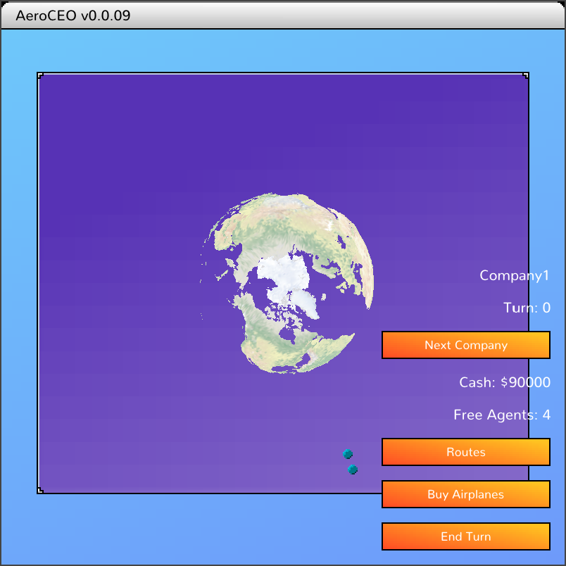
The polygon outlines of landmass, and colors come from Natural Earth Data. I then ran it through a custom program to tessellate and convert it into a 3d model for rendering in game.
This is another good enough for now kind of thing. The 3D model will need a lot more processing work to look nicer, but alternatively I hope to find an artist to do a cool stylized version instead.
It has no effect currently, it just sits there looking cool in the background, while the airports are still on a flat 2d plane. But that will hopefully change very soon!
Previous: Building regional hubsNext: Airports in 3D